
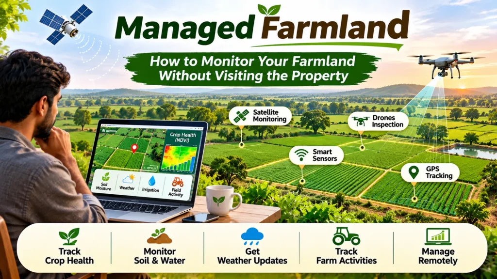
How to Monitor Your Farmland Without Visiting the Property
Managing agricultural land from a distance can be challenging, especially when landowners cannot visit their farms regularly. Whether farmland is located in another city, state, or region, keeping track of crop growth, soil conditions, irrigation, and field activities is essential for maintaining agricultural productivity.
Fortunately, improvements in agricultural technology have made remote farmland monitoring a far easier and more efficient proposition. Landowners and farm managers can now use satellite imagery, drones, GPS, smart sensors, mobile apps, and digital farm management platforms to monitor their farmland without having to be on site.
These technologies give you a great deal of information on crop health, the weather, water, and field conditions. When you combine that with regular contact with the farm staff and the local managers, you can make the right decisions and deal with issues as they arise.
Why Is Remote Farmland Monitoring Important?
Remote farmland monitoring allows landowners to stay informed about their agricultural property without being physically present. It is particularly useful for individuals who own farmland in distant locations or manage multiple agricultural properties.
Some important reasons for adopting remote farmland monitoring include:
- Better Farm Management: Landowners can monitor agricultural activities and receive regular updates about field conditions.
- Time Efficiency: Remote monitoring reduces the need for frequent travel to agricultural properties.
- Early Problem Detection: Changes in crop health, irrigation, or soil condition can be picked up before they become a major problem.
- Improved Decision-Making: Digital information enables landowners and farm managers to make better-informed decisions about their agricultural operations.
- Cost Management: Monitoring tools can help identify inefficient resource use and reduce unnecessary operational expenses.
- Multiple Property Management: Owners can monitor different agricultural properties through centralized digital platforms.
Effective Ways to Monitor Managed Farmland Remotely
- Use Satellite Imagery for Crop Monitoring
Satellite imagery is one of the most useful technologies for monitoring farmland remotely. Satellites capture images of agricultural areas at regular intervals, allowing landowners to observe changes in crop growth and field conditions over time.
Modern satellite monitoring platforms use vegetation indices such as the Normalized Difference Vegetation Index (NDVI) to assess vegetation health.
NDVI measures the difference between near-infrared and red light reflected by vegetation. It can help identify variations in plant growth and highlight areas that may require further inspection.
Benefits of satellite monitoring:
- Tracks the health of vegetation over large areas of agriculture.
- Identifies anomalous changes in crop growth.
- Helps to detect potential water stress and crop damage.
- Provides a visual record of field conditions over time.
- Reduces the need for frequent physical inspections.
Satellite images may be affected by cloud cover, image resolution, and observation frequency. Therefore, they should be combined with ground-level information whenever possible.
- Install Smart Agricultural Sensors
Smart sensors help landowners monitor important environmental and soil conditions without visiting their farmland.
These devices collect information and transmit it to connected mobile applications or digital monitoring platforms.
Common agricultural sensors include:
- Soil Moisture Sensors: Measure the amount of water present in the soil and help determine irrigation requirements.
- Soil Temperature Sensors: Monitor soil temperature, which influences seed germination and root development.
- Weather Sensors: Record temperature, humidity, rainfall, and wind speed.
- Soil Electrical Conductivity Sensors: Help assess soil salinity and variations in soil conditions.
- Water-Level Sensors: Monitor water availability in tanks, reservoirs, and irrigation systems.
Many smart sensors use wireless communication technologies such as Wi-Fi, cellular networks, LoRaWAN, or other IoT-based systems to transmit information.
These devices help landowners understand changing field conditions and respond to agricultural requirements more efficiently.
- Monitor Farmland Using Agricultural Drones
Drones, also known as Unmanned Aerial Vehicles (UAVs), are increasingly used in precision agriculture.
Equipped with cameras and specialized sensors, agricultural drones capture aerial images of farmland and provide detailed information about crop conditions.
Depending on the equipment used, drones can help monitor:
- Crop growth and plant density.
- Pest infestations and disease symptoms.
- Irrigation problems and waterlogged areas.
- Crop damage caused by extreme weather.
- Variations in vegetation and field conditions.
Some advanced drones use multispectral or thermal cameras to identify crop stress that may not be easily visible in ordinary photographs.
Drone monitoring can be particularly useful for large agricultural properties. However, flights require appropriate permissions and compliance with applicable aviation regulations.
- Use Gps Technology to Track Farm Activities
Global Positioning System (GPS) technology helps landowners and farm managers monitor agricultural activities and equipment movement.
GPS-enabled devices can provide information about the location of agricultural machinery, vehicles, and field operations.
For example, landowners can use GPS tracking systems to monitor:
- Tractor and machinery movement.
- Field coverage during sowing and spraying.
- Movement of agricultural vehicles.
- Locations of specific field operations.
- Boundaries and areas of agricultural land.
GPS technology can also help create digital maps of farmland, making it easier to identify different plots, irrigation systems, access roads, and other important features.
- Use Farm Management Mobile Applications
Farm management applications provide a centralized platform for organizing and monitoring agricultural activities.
These applications allow landowners to access farm-related information through smartphones, tablets, or computers.
Some applications also allow farm workers and local managers to upload photographs, videos, and progress reports directly from the property.
This creates a digital record of agricultural operations and helps landowners remain informed about everyday farm activities.
- Install Security Cameras and Remote Surveillance Systems
Security cameras can help landowners observe their farmland and monitor activities taking place on the property.
Solar-powered cameras and cellular-enabled surveillance systems are particularly useful in agricultural locations where electricity and internet connectivity may be limited.
Depending on the system, cameras may provide:
- Live video streaming.
- Motion detection alerts.
- Night vision.
- Recorded footage.
- Remote access through mobile applications.
Security cameras can help monitor entrances, storage facilities, equipment sheds, irrigation infrastructure, and other important areas.
However, cameras should be installed in suitable locations with respect for workers’ privacy and applicable surveillance regulations.
- Maintain Regular Communication with Local Farm Managers
Technology is valuable, but remote farmland management also depends on reliable communication with people working on the property.
Landowners should establish a clear reporting system with farm managers, supervisors, or agricultural workers.
A useful reporting routine may include:
- Weekly photographs of important field areas.
- Updates on sowing, irrigation, fertilization, and harvesting.
- Reports about pest attacks or crop diseases.
- Records of labor and machinery expenses.
- Updates about equipment maintenance.
- Immediate communication about unusual incidents.
Photographs and videos should ideally include dates and identifiable field locations to make verification easier.
Regular communication enables landowners to compare the digital monitoring data with the real field conditions.
- Use Weather Monitoring and Forecasting Tools
Weather has a massive impact on agricultural production. Changes in rainfall, temperature, humidity, and wind speed all have an impact on crop development and irrigation needs.
Weather monitoring apps and local weather stations enable landowners to get information on the current and forecasted weather.
Local weather stations generally provide more location-specific information than broad regional forecasts.
How to Combine Different Technologies for Better Farmland Monitoring
Using a single monitoring tool may not provide a complete understanding of agricultural conditions. A combination of digital technologies and local field reports can provide more reliable information.
For example, landowners can follow this approach:
Step 1: Create a Digital Map of the Property
Use GPS-based mapping tools or satellite imagery to identify field boundaries, crop areas, water sources, access roads, and important infrastructure.
Step 2: Monitor Crop Health Through Satellite Images
Review satellite imagery periodically to identify changes in vegetation and locate areas that may require further investigation.
Step 3: Install Soil and Weather Sensors
Use connected sensors to monitor soil moisture, temperature, rainfall, and other important environmental conditions.
Step 4: Schedule Drone Inspections
Arrange periodic drone surveys to obtain detailed aerial images of crop conditions and identify problems that require attention.
Step 5: Establish a Reporting System
Ask local farm managers to share regular photographs, expense records, and updates about agricultural operations.
Step 6: Review Data Through a Centralised Platform
Use a farm management application or digital dashboard to organize reports, sensor readings, images, and agricultural records.
This approach provides a more comprehensive picture of farmland conditions without requiring the owner to visit the property frequently.
Benefits of Remote Farmland Monitoring
Remote farmland monitoring offers several advantages for agricultural landowners and farm managers.
- Saves Time and Travel Expenses
Landowners can get access to key farm information from the comfort of their home or office, thus reducing the need to travel to the various farm sites.
- Improves Crop Management
Regular access to crop health information, soil moisture readings, and weather updates enables the farmer to spot problems and act on them in a timely manner.
- Supports Efficient Resource Utilisation
Smart monitoring tools help identify irrigation requirements, monitor water consumption, and improve the management of agricultural inputs.
- Helps Prevent Agricultural Losses
Early identification of crop stress, irrigation failures, pest infestations, and other problems can help reduce potential production losses.
- Improves Transparency and Accountability
Digital records, photos, GPS data, and expense reports all help landowners have a much better oversight of their farming operations.
- Supports Data-Driven Decisions
Historical information about crop growth, weather, soil conditions, and farm expenses can help landowners plan future agricultural activities more effectively.
Challenges of Monitoring Farmland Remotely
Although remote monitoring offers several advantages, landowners should also understand its limitations.
- Internet Connectivity
Agricultural properties in remote locations may have limited mobile network coverage, affecting real-time data transmission.
- Initial Investment
Installing the sensors, surveillance cameras, drones, and other monitoring equipment can be a costly proposition in terms of the initial outlay.
- Technical Knowledge
Some digital platforms will require a basic level of technical know-how in order to make sense of the satellite imagery, the sensor data, and the agricultural data.
- Equipment Maintenance
Sensors, cameras and comms gear all require regular maintenance to ensure accurate monitoring.
- Dependence on Local Personnel
Technology can’t entirely replace the physical inspection. You still need reliable local workers and farm managers to check things out and carry out the work that needs to be done.
- Data Accuracy
Satellite imagery and sensor readings don’t always give you the real world on the ground. There are all sorts of things that can go wrong with the equipment (limited capability, etc.), cloud cover, calibration errors, and communication problems.
Conclusion
Monitoring of managed farmland without actually visiting the property has become a very real possibility thanks to the advances in agricultural technology. You can now monitor your farmland via satellite imagery, smart sensors, agricultural drones, GPS tracking, mobile apps, and remote monitoring. You can keep a very close eye on crop health, field activity, and the state of the farm infrastructure.
Successful remote farmland management requires far more than just the technology. It’s only by combining the technology with some degree of local supervision, regular reporting, and periodic physical inspection that you can be sure that the decisions being made are actually based on accurate information.
By using the right remote monitoring solutions, you can save time, improve farm management, use your resources more efficiently, and have a far better degree of control over your land.